OpenEarthMap: Open Machine Learning-Based Mapping for All
Advancing Global Mapping with AI and Remote Sensing
Introduction
OpenEarthMap is a global initiative dedicated to advancing open and accessible machine learning-based mapping using remote sensing data. The project focuses on extracting semantic and height information, such as land cover maps and digital elevation models (DEMs), to support critical applications in environmental monitoring, urban planning, and disaster management.
Built upon the OpenEarthMap dataset—a high-resolution land cover mapping benchmark—the project promotes the development of models that generalize worldwide, ensuring accurate and scalable geospatial analysis. By making mapping technologies openly available, OpenEarthMap aims to bridge geographic inequalities, empowering researchers, policymakers, and local communities worldwide to develop and deploy their own mapping solutions.
Datasets & Initiatives
OpenEarthMap encompasses a diverse set of datasets and research initiatives aimed at pushing the boundaries of AI-driven geospatial analysis.
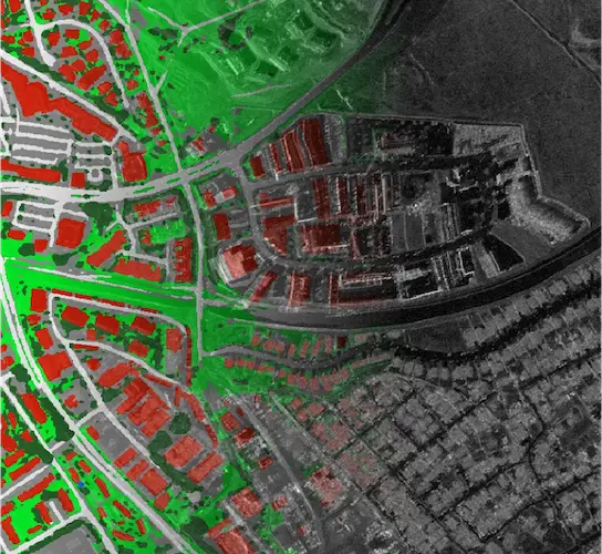
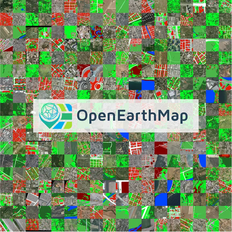
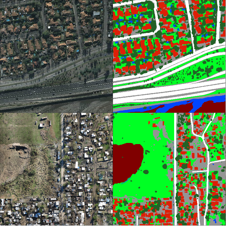
Land Cover Mapping – OpenEarthMap Dataset
OpenEarthMap serves as a benchmark dataset for global high-resolution land cover mapping. It consists of 5,000 aerial and satellite images, manually annotated with 8-class land cover labels across 97 regions in 44 countries on six continents. With a 0.25-0.5m ground sampling distance, models trained on OpenEarthMap achieve strong generalization worldwide, enabling off-the-shelf applications across various geospatial tasks.
🌐 Project Page: Dataset Overview🔗 Data: Zenodo Repository
📜 Publication: WACV 2023 Paper
🏆 Competition: OpenEarthMap Benchmark
Synthetic Data for Land Cover & Change Detection – SyntheWorld
To enhance the generalization of machine learning models, we developed SyntheWorld, a large-scale synthetic dataset for land cover mapping and building change detection. Constructed using a remote sensing image synthesis system that integrates procedural modeling and generative AI, SyntheWorld enables robust training by combining synthetic and real-world data.
🌐 Project Page: GitHub Repository🔗 Data: Zenodo Repository
📜 Publication: WACV 2024 Paper
Few-Shot Learning – OpenEarthMap Few-Shot Challenge
The OpenEarthMap Few-Shot Challenge, hosted at the CVPR 2024 Workshop on Learning with Limited Labeled Data (L3D-IVU), pushes the boundaries of few-shot semantic segmentation in remote sensing. This initiative focuses on minimizing labeled data requirements, addressing key challenges in disaster response, urban planning, and resource management. Top-performing models will be showcased at CVPR 2024, contributing to AI for social good.
🌐 Project Page: GitHub Repository🔗 Data: Zenodo Repository
📜 Publication: IEEE GRSL 2024 Paper
🏆 Competition: OpenEarthMap Few-Shot Challenge
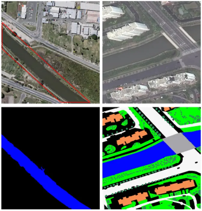
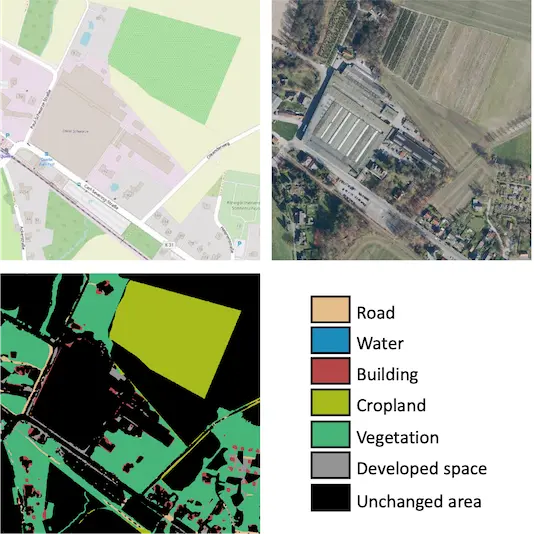
Multimodal Change Detection – OpenMapCD
OpenMapCD is the first benchmark dataset for multimodal change detection using optical remote sensing imagery and OpenStreetMap data. Covering 1,287 samples from 40 regions across six continents, it supports both binary and semantic change detection. A key innovation, Object-Guided Transformer (ObjFormer), integrates object-based image analysis with Transformer architectures, drastically reducing computational overhead without additional parameters.
🌐 Project Page: GitHub Repository🔗 Data: Zenodo Repository
📜 Publication: IEEE TGRS 2024 Paper
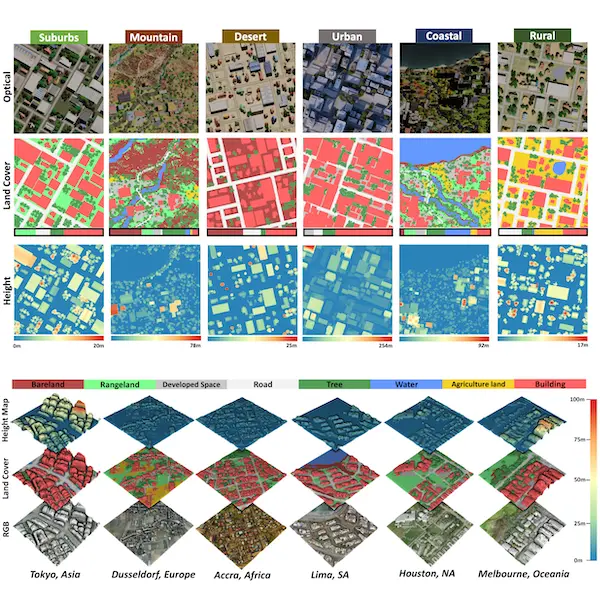
Synthetic Data for 3D Semantic Understanding – SynRS3D
Presented at NeurIPS 2024, SynRS3D is the largest synthetic dataset for global single-view height estimation and land cover mapping, expanding OpenEarthMap into the 3D domain. It enables large-scale semantic 3D understanding from high-resolution remote sensing imagery. To ensure effective transfer from synthetic to real-world scenarios, we introduce RS3DAda, a novel multi-task unsupervised domain adaptation (UDA) method for improved monocular 3D semantic understanding.
🌐 Project Page: GitHub Repository🔗 Data: Zenodo Repository
📜 Publication: NeurIPS 2024 Spotlight Poster
All-Weather Land Cover Mapping – OpenEarthMap-SAR
Expanding OpenEarthMap into the SAR domain, OpenEarthMap-SAR introduces sub-meter-level synthetic aperture radar (SAR) imagery for all-weather land cover mapping. Leveraging open SAR data from Umbra and Capella Space, this dataset facilitates high-resolution 8-class land cover mapping, ensuring robust performance regardless of weather conditions. As the foundation for Track 1 of the 2025 IEEE GRSS Data Fusion Contest, OpenEarthMap-SAR drives advancements in SAR-based geospatial analysis.
🌐 Project Page: GitHub Repository🔗 Data: Zenodo Repository
📜 Publication: ArXiv Paper
🏆 Competition: 2025 IEEE GRSS DFC Track 1